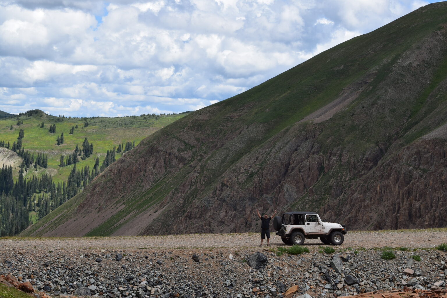
Specializing in Drone Services, and Aerial Photography
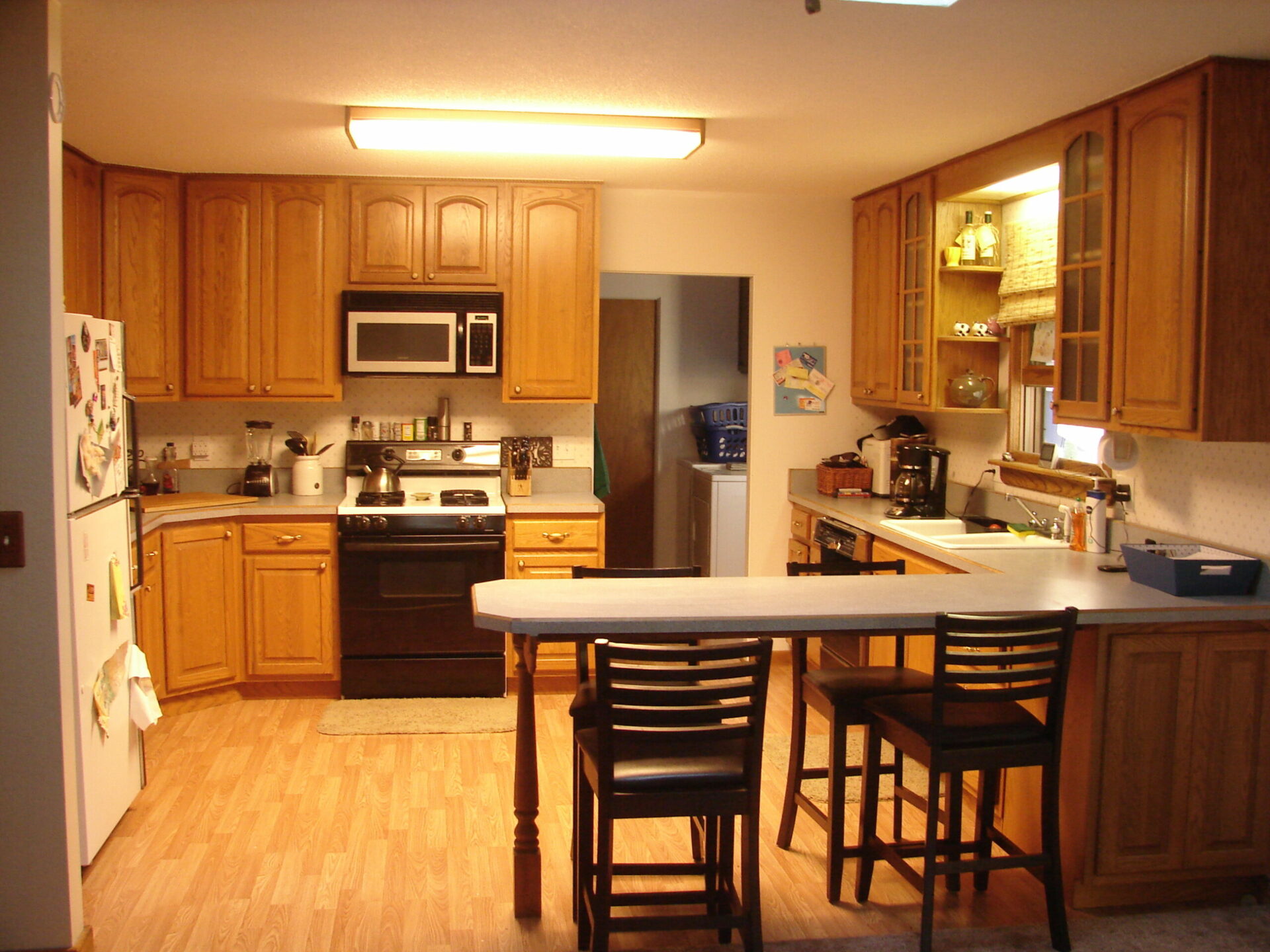
SJDS is here to provide a variety of services including utility inspection and corridor mapping, photogrammetry products, recreational videography , and real estate packages that include exterior aerial and ground level images as well as interior photographs and 360° walkthroughs.
SJDS is available and ready to provide our wide range of drone services where needed 24/7, and we look forward to answering any questions you have. As our company grows so will our site, thank you for visiting and we look forward to working with you.
San Juan Drone Services has the expertise & tools to elevate your business.
We have a passion for the incredible uses of drones for running more efficient operations, capturing the beauty of nature and real estate and troubleshooting hard to reach places with multiple views and lenses.
0+
Happy Client
0+
Aerial Filming
0+
Aerial Photo
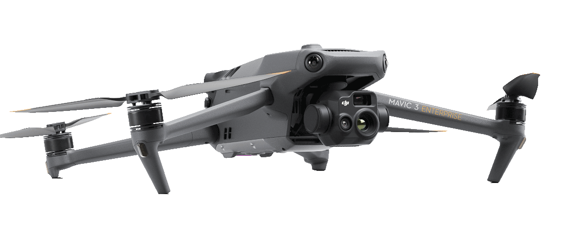
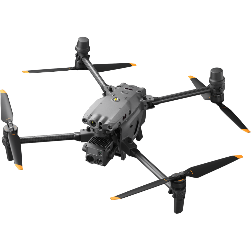
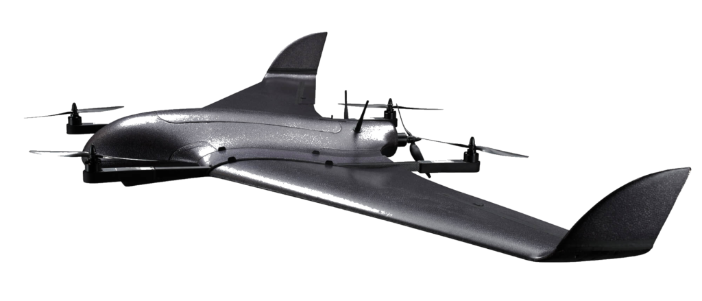
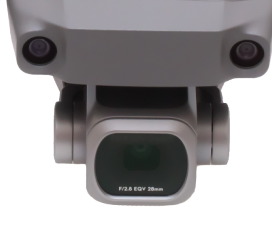
Our Flagship Drone
DeltaQuad MK4 (Pro Map) VTOL
Industry leading VTOL mapping UAV The DeltaQuad MK4 mapping UAV offers smart technology and powerful performance that enables easy and productive mapping & surveying.
Coverage up to 1200HA
A 61 MP mapping sensor together with a flight time of 110 minutes, adds up to an coverage of 1200Ha at 3/CM per pixel in one flight.
61 megapixel camera
We provide an option to add the highest resolution camera. Using the 61MP camera ensures you get the maximum possible coverage.
Corridor scans up to 50 kilometer
Long range corridor scans are possible up to 50KM. If available, a 4G/LTE network can enable unlimited range and provide redundancy.
Deployable in rain or snow
Smart technology gives the DeltaQuad the unique ability to safely fly in rain & snow.
AERIAL PROJECT
Some Beautiful Projects
Lorem ipsum dolor sit amet, consectetur adipiscing elit, sed do eiusmod tempor incididunt ut labore et dolore magna aliqua. Ut enim ad minim veniam.
Beautiful Seaside
Lorem ipsum dolor sit amet, consectetur adipiscing elit. Sem pulvinar vulputate urna sit at odio cursus porta. Sed sit nec odio a odio tincidunt duis viverra facilisi.
Lorem ipsum dolor sit amet, consectetur adipiscing elit. Sem pulvinar vulputate urna sit at odio cursus porta. Sed sit nec odio a odio tincidunt duis viverra facilisi.
Lorem ipsum dolor sit amet, consectetur adipiscing elit. Sem pulvinar vulputate urna sit at odio cursus porta. Sed sit nec odio a odio tincidunt duis viverra facilisi.
Lorem ipsum dolor sit amet, consectetur adipiscing elit. Sem pulvinar vulputate urna sit at odio cursus porta. Sed sit nec odio a odio tincidunt duis viverra facilisi.
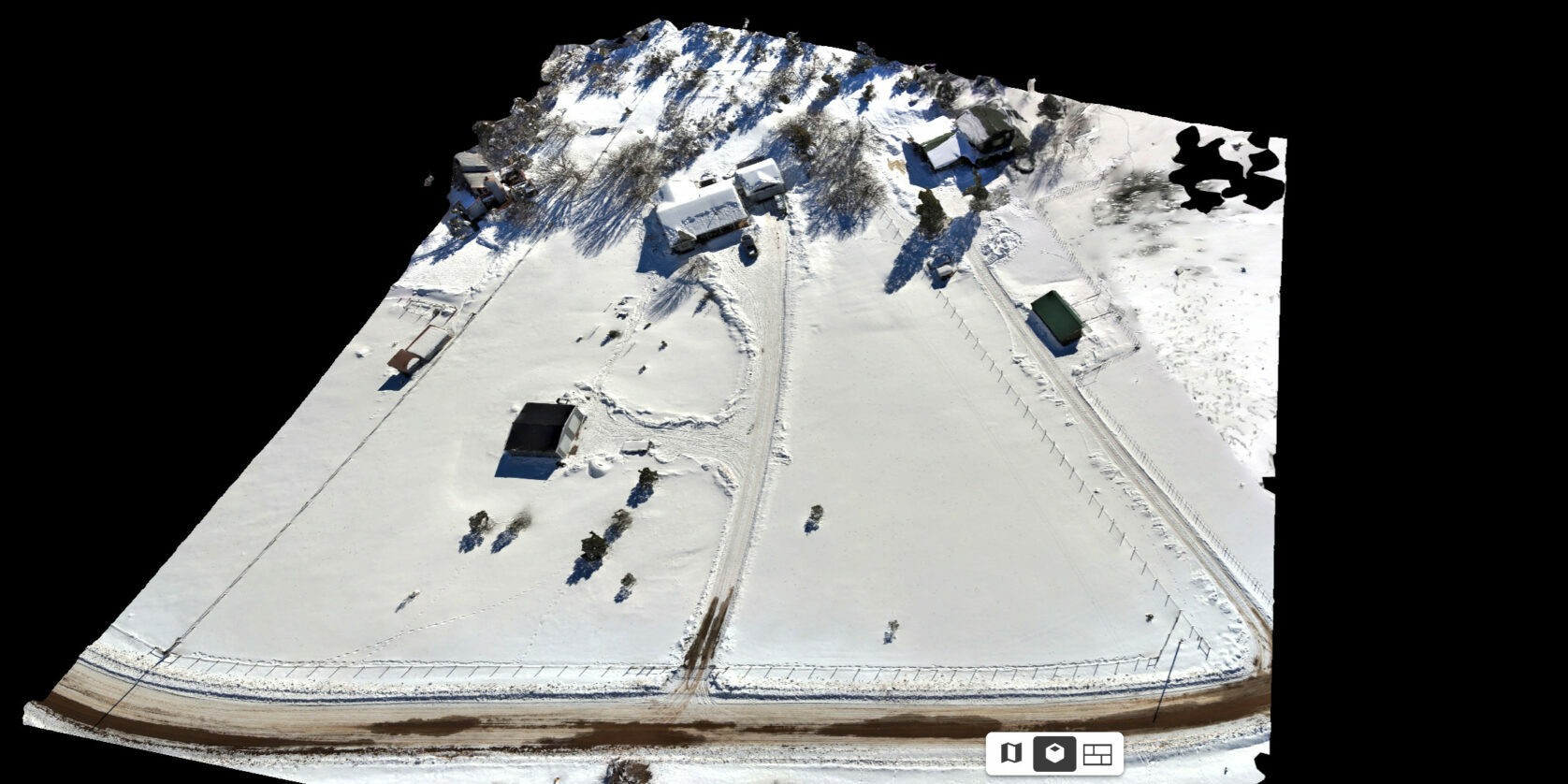
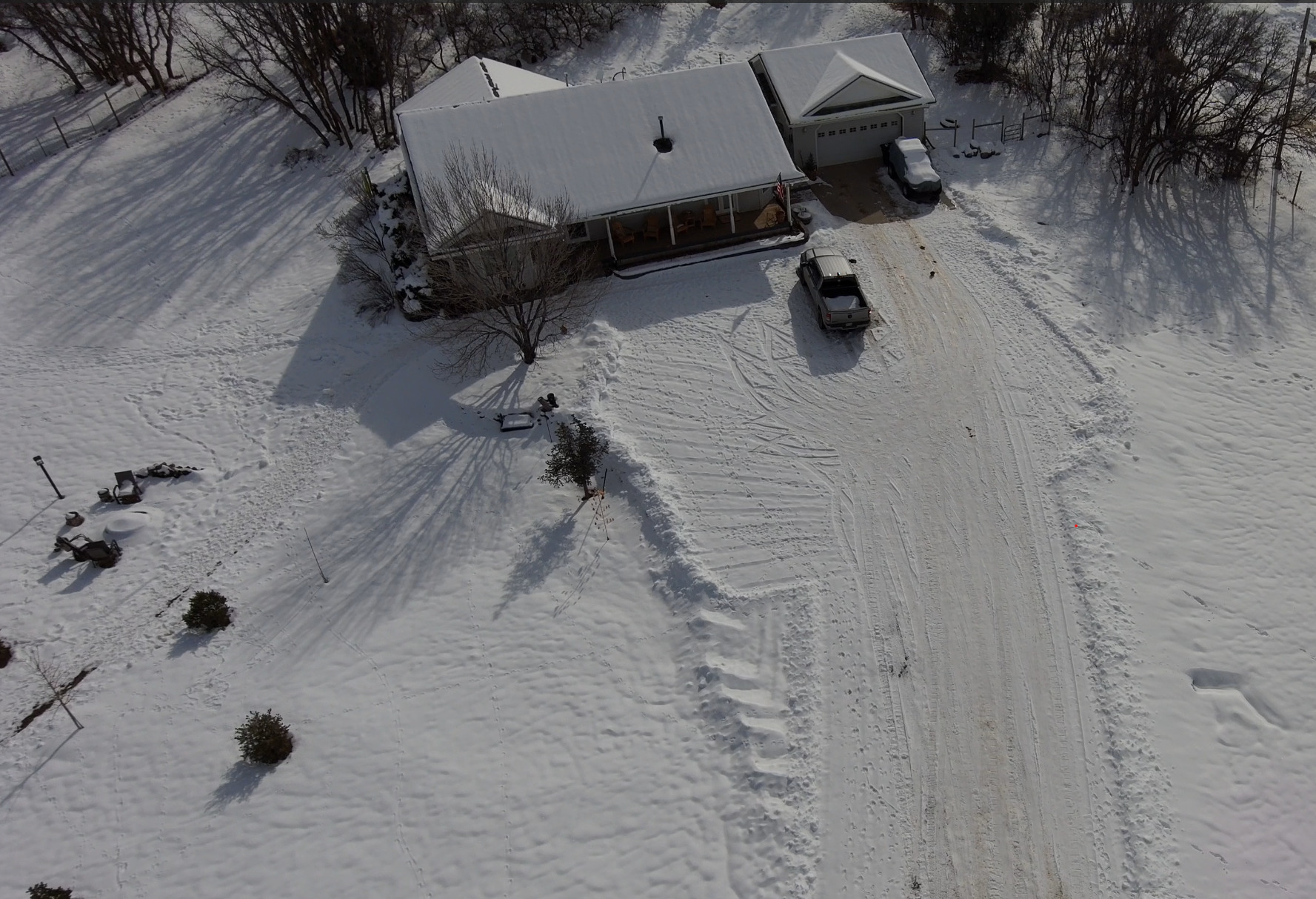
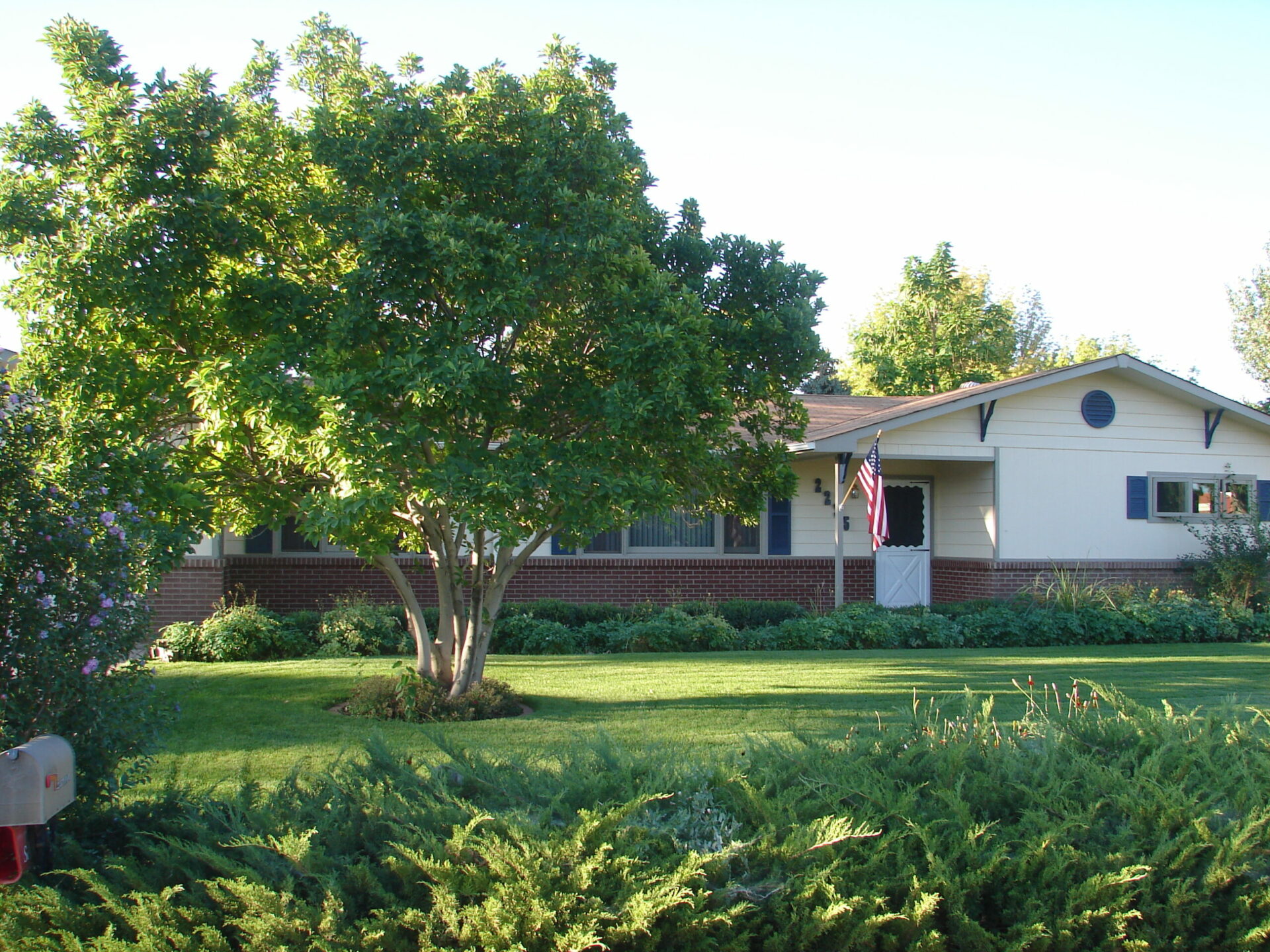
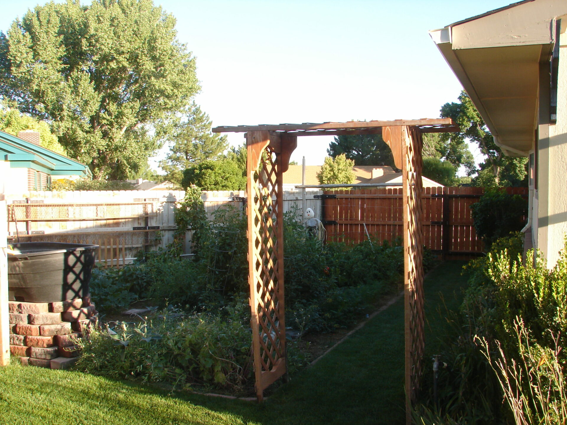
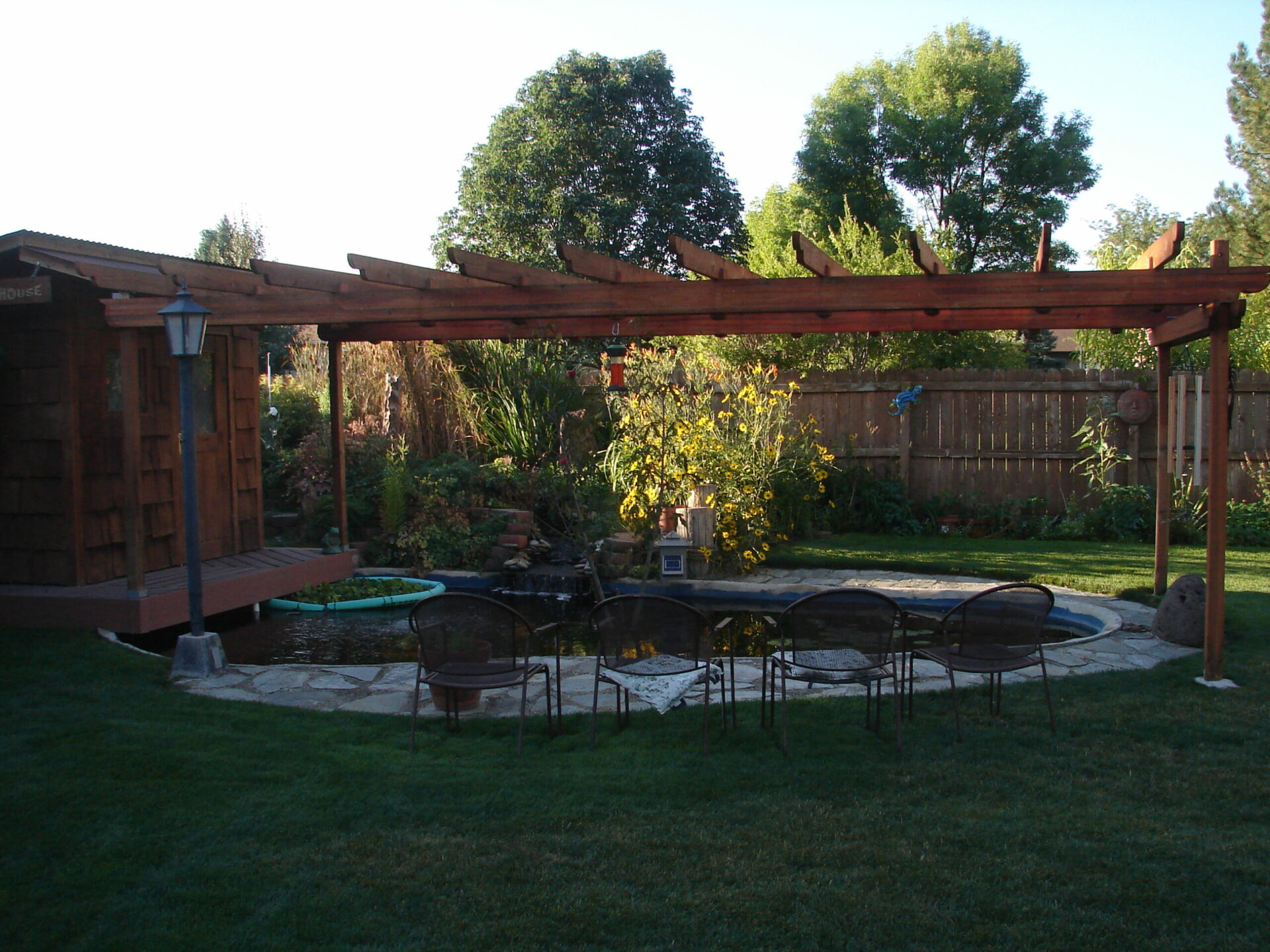
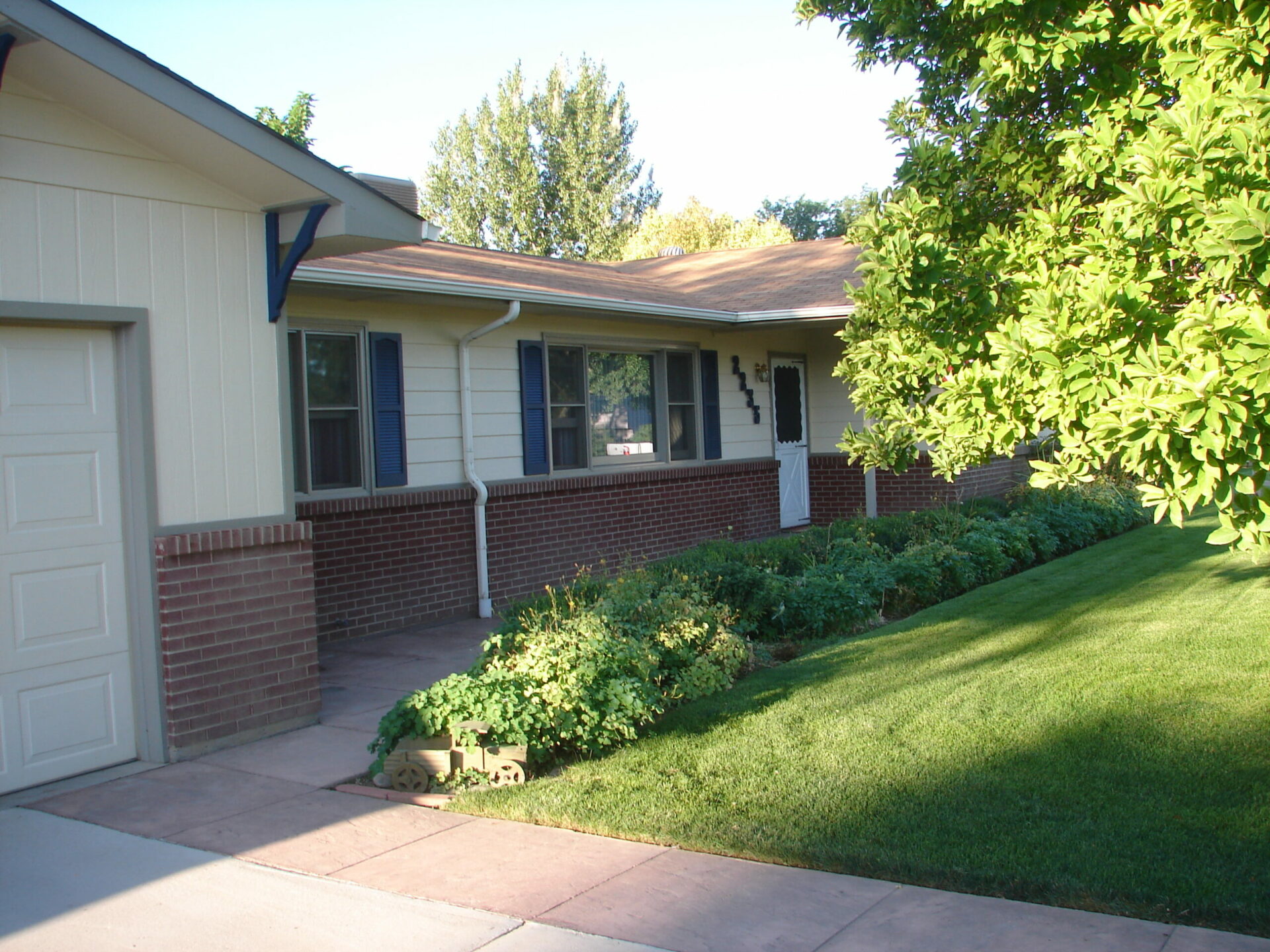
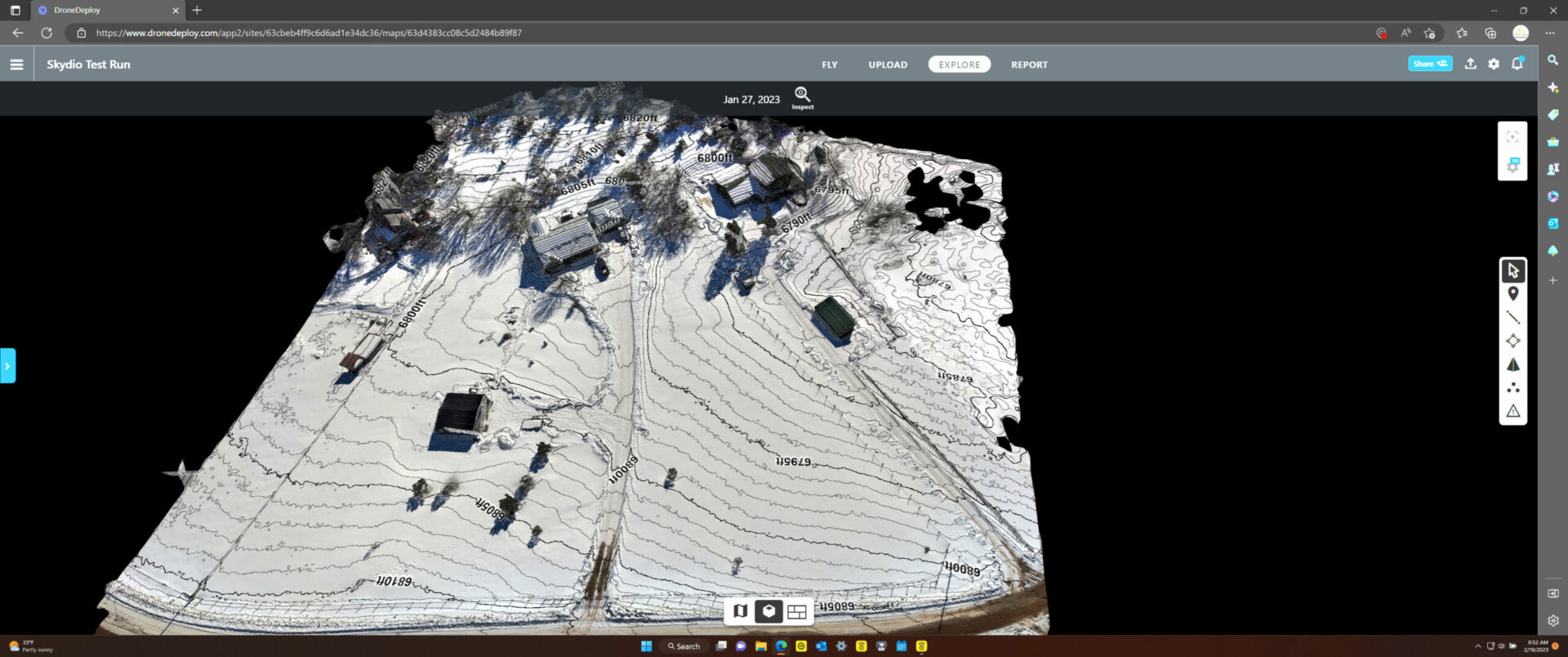
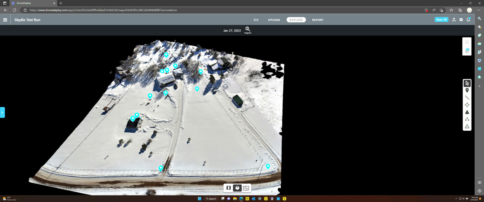
Our Annotation Software Brings Context to Your Site
Need to keep a record of where hidden infrastructure is, notes for work to be done at a particular site, or highlight property features for real estate? No problem, we have the tools and technology to make your imagery come to life with information.
Security Gate
40x40 Shop Wired for 220V Tools
Water Main
Propane Tank
Fire Pit
Septic System
500 Gallon Buried Propane Tank
LPEA Transformer
25x12 Greenhouse
Hot Tub
AC Unit
Garden
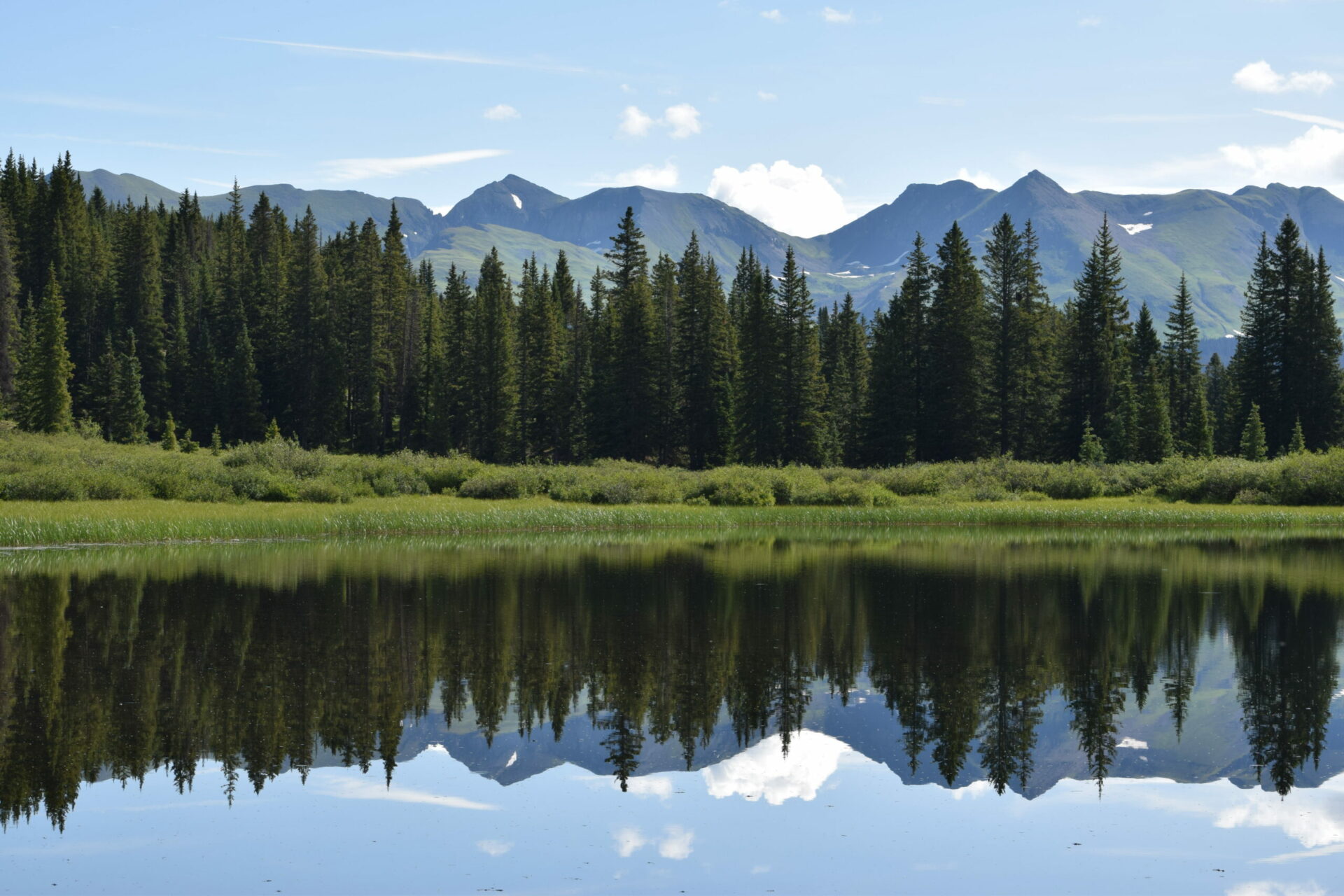
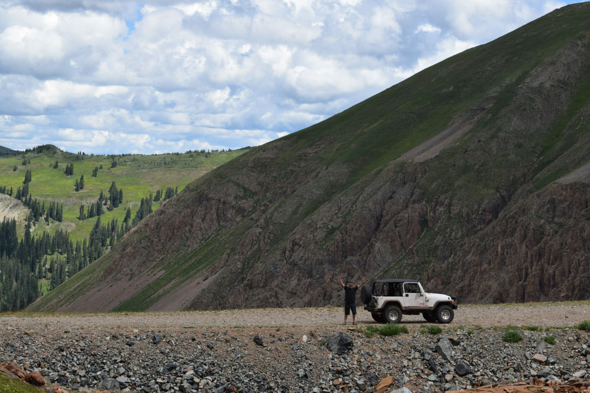
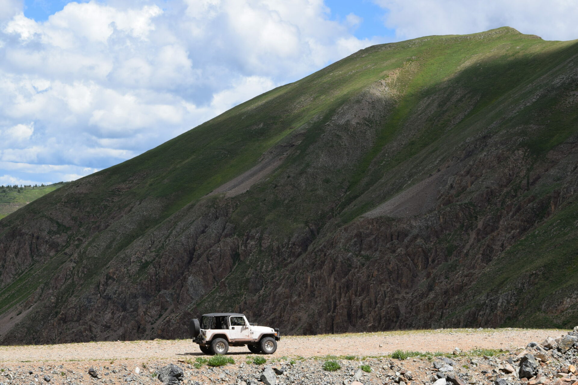
Our Gallery
Applications of San Juan Drone Services Technology and Expertise.
San Juan Drone Services is pleased to offer drone video footage for recreational videography. Whether you are an outdoor enthusiast, traveler, or just looking to capture stunning footage of your backyard, drone video is a game-changer. Here are some of the benefits of using drone video footage for your recreational videography needs:
Stunning Views: Drones provide a unique vantage point that can capture stunning views that would be impossible to achieve otherwise. Whether you are filming a mountain range, a beach, or a cityscape, drone video can provide an awe-inspiring perspective.
Versatility: Drones are highly versatile and can capture video footage from a variety of angles and heights. This means that you can create videos with unique and dynamic shots that are sure to impress your audience.
Convenience: Drone video is also highly convenient. Rather than having to trek through difficult terrain to get the perfect shot, a drone can capture the footage you need from above. This makes it easier to capture footage in remote or hard-to-reach locations.
Cost-effective: Using a drone for recreational videography is also highly cost-effective. Traditional methods of capturing aerial footage, such as hiring a helicopter, can be prohibitively expensive. With drone video, you can achieve similar results for a fraction of the cost.
At San Juan Drone Services, we are committed to providing our clients with high-quality drone video footage for their recreational videography needs. Contact us today to learn more about our services and how we can help you capture stunning footage from above.
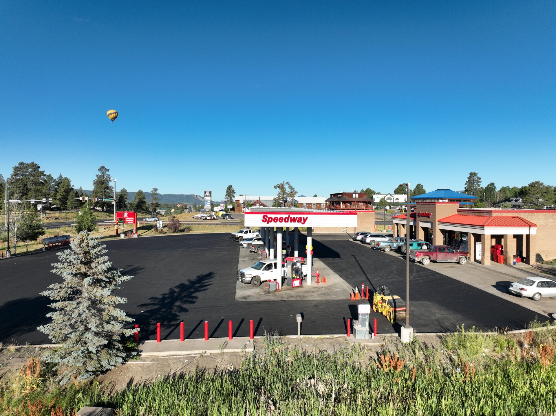
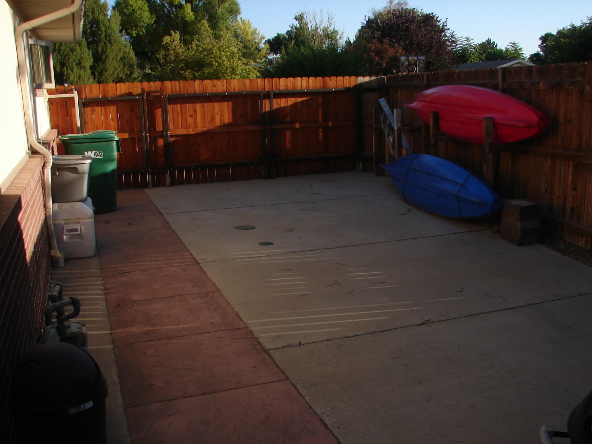
San Juan Drone Services is proud to offer high-quality drone video footage for Real Estate Aerial Photography. Our services provide an innovative and dynamic way to showcase properties from unique perspectives, capturing stunning aerial views that traditional photography simply cannot achieve. Here are some of the benefits of using drone video footage for your real estate photography needs:
Showcasing the Property: Drones can capture footage of the property from all angles, giving potential buyers an immersive experience that cannot be replicated with traditional photography. With drone video, buyers can see the property’s layout and its surroundings in a way that will help them understand the full scope and scale of the property.
Attracting Buyers: High-quality drone video footage can attract more buyers and help your properties stand out in a crowded market. With drone video, you can create a compelling and engaging visual experience that will grab the attention of potential buyers and keep them interested.
Saving Time: Drone video footage can save time for real estate agents and potential buyers. Instead of having to schedule multiple site visits, buyers can get a better sense of the property from the drone video footage, and agents can use the footage to showcase the property to multiple potential buyers.
Cost-effective: Using drone video footage for real estate aerial photography is also highly cost-effective. Our services provide a cost-efficient way to capture stunning aerial footage, allowing you to market your properties in a more visually appealing and dynamic way.
At San Juan Drone Services, we are committed to providing our clients with high-quality drone video footage for their real estate aerial photography needs. Contact us today to learn more about our services and how we can help you showcase your properties in the most visually compelling way possible.
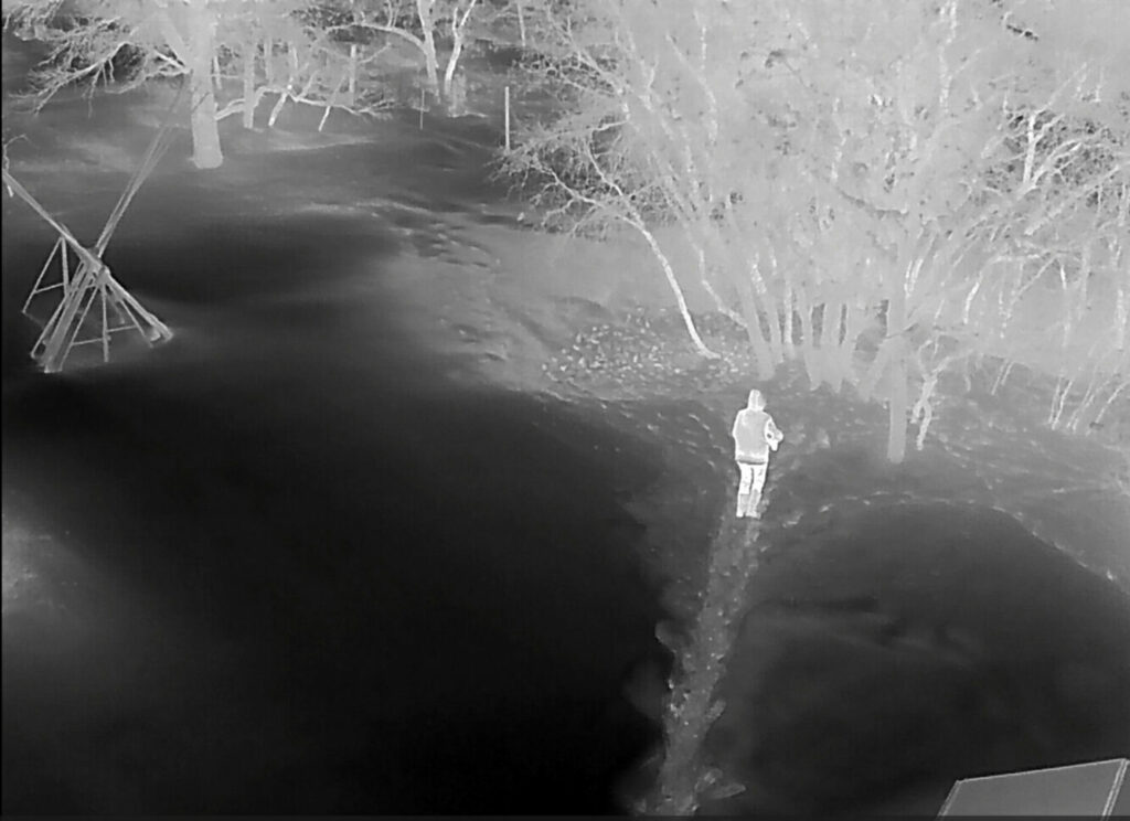
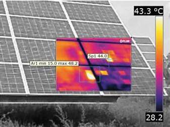
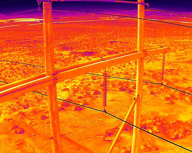
San Juan Drone Services is excited to offer drone video footage for Thermal Imaging. Thermal imaging provides a unique perspective that is useful in a wide range of applications, from construction and infrastructure maintenance to agriculture and environmental monitoring. Here are some of the benefits and uses of drone video footage for thermal imaging:
Detection of Heat Loss and Energy Efficiency: Thermal imaging can be used to detect heat loss and energy efficiency issues in buildings and other structures. This can help save energy and reduce utility costs.
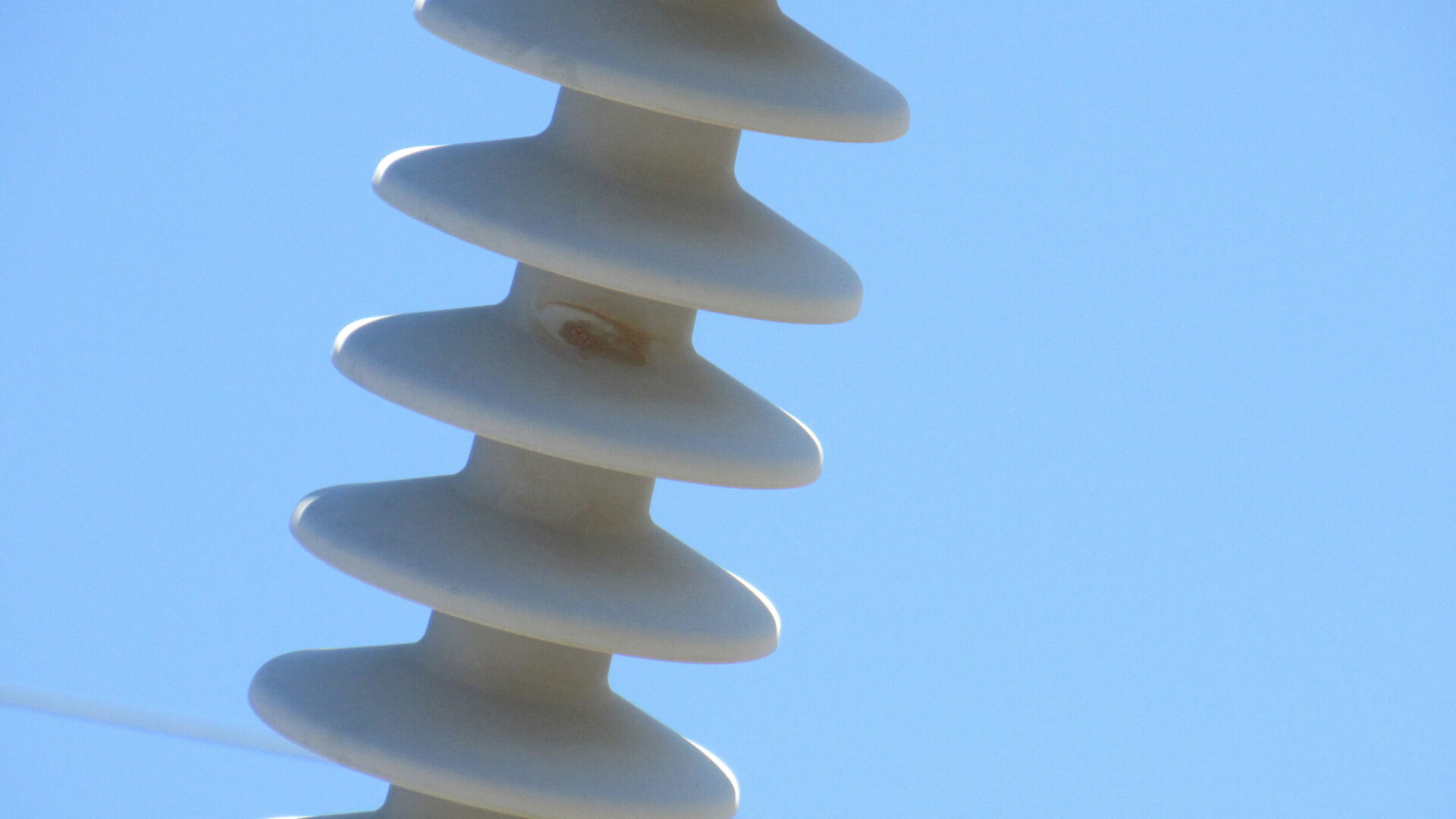
Infrastructure Inspections: Thermal imaging can also be used to inspect infrastructure such as power lines, bridges, and pipelines. It can detect areas of heat build-up that may indicate a problem, allowing maintenance crews to address the issue before it becomes a major problem.
Agriculture: Thermal imaging can be used in agriculture to monitor crop health and identify areas of stress or disease. This can help farmers address issues before they become widespread, potentially saving crops and improving yields.
Environmental Monitoring: Thermal imaging can also be used to monitor wildlife, map wetlands, and identify areas of pollution or contamination. This can be useful in a range of environmental monitoring applications.
At San Juan Drone Services, we are committed to providing our clients with high-quality drone video footage for thermal imaging. Our services can help you identify issues and improve efficiency in a wide range of applications. Contact us today to learn more about our services and how we can help you with your thermal imaging needs.
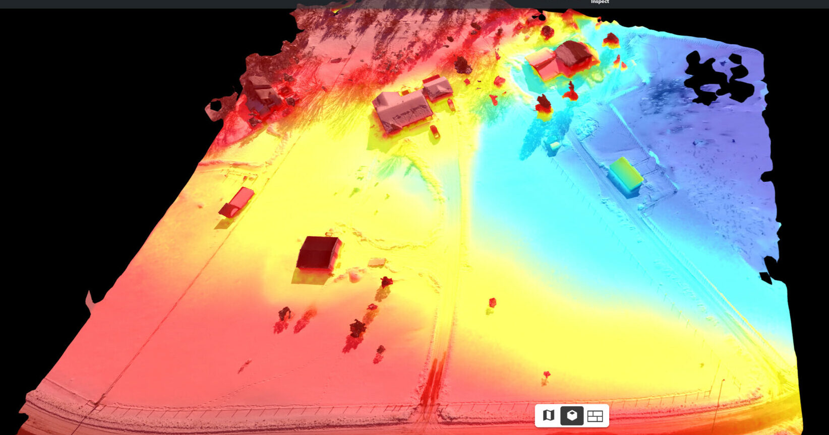
Photogrammetry: 2-D, 3-D, Elevation, and Contour Mapping
San Juan Drone Services is thrilled to offer drone video footage for photogrammetry. Our services provide a unique and innovative way to create 2-D and 3-D maps, as well as elevation and contour maps. Here are some of the benefits and uses of drone video footage for photogrammetry:
Accurate Mapping: Drones can capture images from multiple angles and heights, providing a more accurate and comprehensive view of the area being mapped. This can lead to more accurate 2-D and 3-D maps, elevation maps, and contour maps.
Time and Cost Savings: Traditional methods of mapping can be time-consuming and expensive. With drone video footage for photogrammetry, maps can be created quickly and at a fraction of the cost of traditional methods.
Wide Range of Applications: Photogrammetry using drone video footage can be used in a wide range of applications, including construction, surveying, urban planning, and environmental monitoring.
Detailed Visualizations: Drone video footage can provide highly detailed visualizations of the mapped area, making it easier to identify potential issues or areas of concern. This can help in planning and decision-making processes.
At San Juan Drone Services, we are committed to providing our clients with high-quality drone video footage for photogrammetry. Our services can help you create accurate maps for a range of applications, saving you time and money. Contact us today to learn more about our services and how we can help you with your mapping needs.
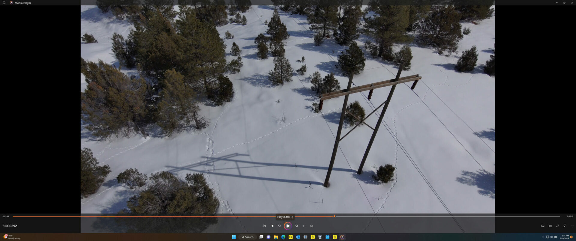
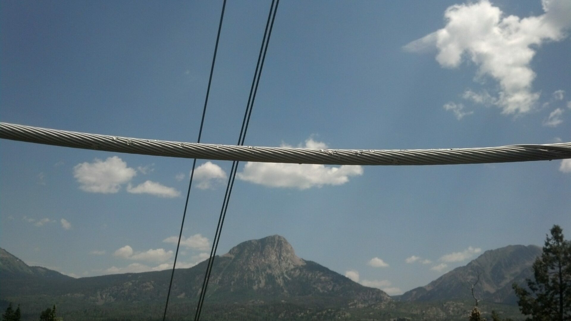
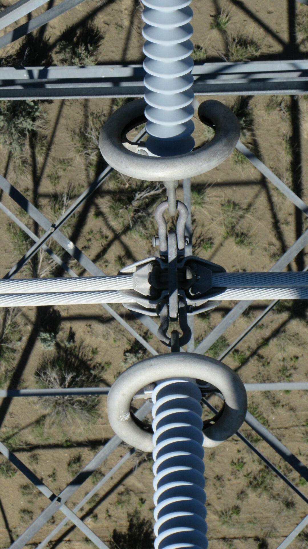
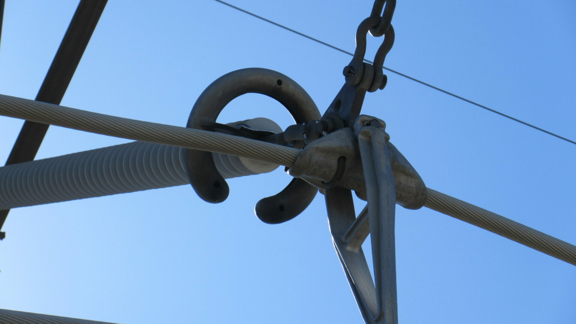
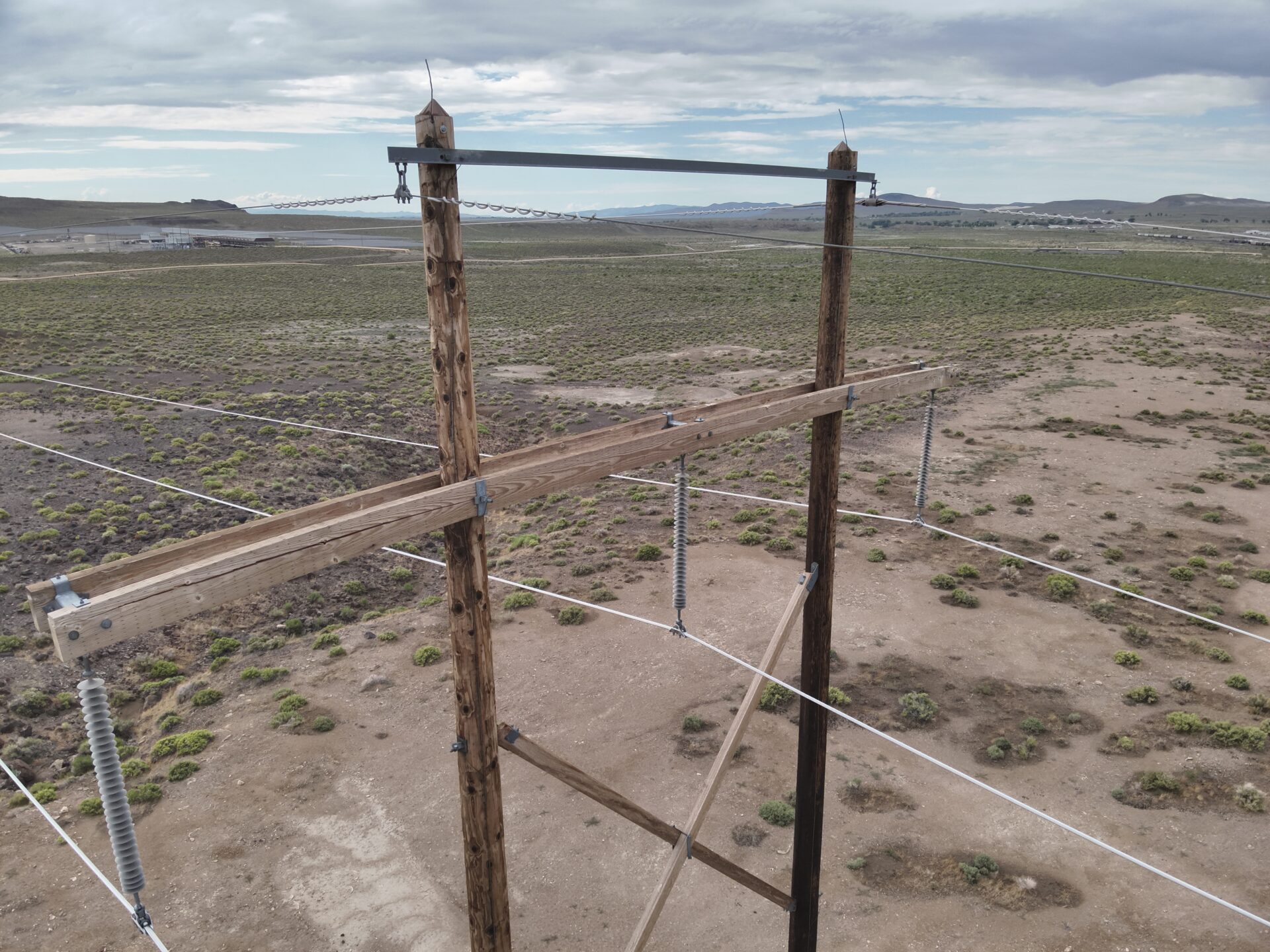
San Juan Drone Services is excited to offer drone video footage for utility inspection and corridor mapping. Our services provide a safe and efficient way to inspect and monitor power lines, pipelines, and other infrastructure, as well as map corridors for planning and analysis purposes. Here are some of the benefits and uses of drone video footage for utility inspection and corridor mapping:
Safety: Drone video footage provides a safe way to inspect and monitor infrastructure, without putting personnel at risk. It can help identify potential issues and hazards, allowing for prompt repairs or maintenance.
Vegetation management: Drones allow us to look at the growth of plants that may negatively affect the integrity of power infrastructure.
Efficiency: Using drones for utility inspection and corridor mapping is a more efficient method than traditional inspection methods. Drones can cover larger areas in less time, allowing for faster and more accurate inspections and mapping.
Accurate Mapping: Drones can capture images from multiple angles and heights, providing more accurate maps and data. This can be useful in planning and decision-making processes.
Cost-effective: Using drones for utility inspection and corridor mapping is also cost-effective. Our services provide a more affordable way to inspect and monitor infrastructure, reducing the need for expensive equipment or personnel.
At San Juan Drone Services, we are committed to providing our clients with high-quality drone video footage for utility inspection and corridor mapping. Our services can help you identify issues and improve efficiency in a wide range of applications. Contact us today to learn more about our services and how we can help you with your utility inspection and corridor mapping needs.


